Introduction
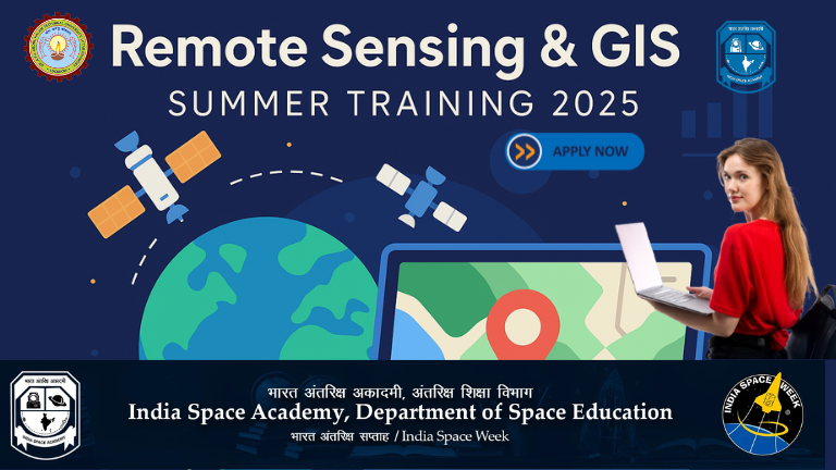
The India Space Academy (ISA) has officially launched the Summer Training Program on Remote Sensing & GIS 2025, a national-level online skill development program aimed at equipping students with industry-demanded geospatial technologies.
This initiative aligns with Prime Minister Narendra Modi’s vision of making India a global leader in space, sustainability, and technology. The training offers a unique opportunity to interact with scientists from ISRO, NASA, IITs, and the India Meteorological Department.
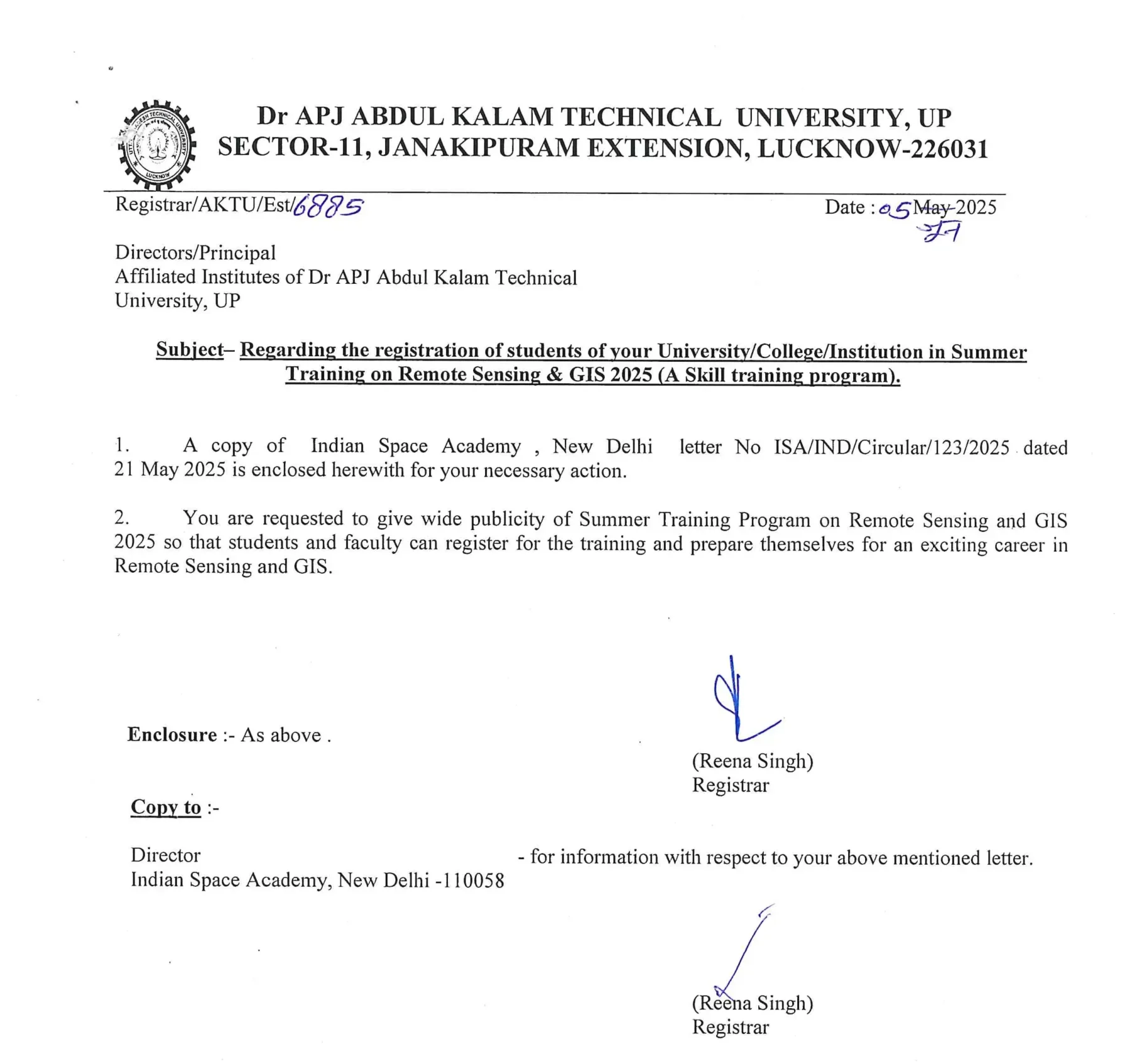
Notice: Regarding the registration of students of your University/College/Institution in Summer Training on Remote Sensing & GIS 2025 (A Skill training program).
Important Links
| AKTU CIRCULAR DOWNLOAD | Download |
| AKTU OFFICIAL SITE | Click Here |
| MORE AKTU CIRCULAR | VISIT HERE |
Why Join the Remote Sensing & GIS Summer Training?
In today’s rapidly advancing world, Remote Sensing and GIS technologies are revolutionizing industries like climate science, agriculture, urban planning, defense, disaster management, and more. This training will provide students with hands-on skills to use satellite data and mapping technologies for real-world problem-solving.
Key Benefits
- Learn from national and international space experts
- Gain certified technical skills in GIS and remote sensing
- Participate in a project-based internship (optional)
- Receive a hard copy certificate by post
Program Overview
| Training Title | Summer Training on Remote Sensing & GIS 2025 |
|---|---|
| Mode | Online (Live + Recorded Sessions) |
| Start Date | July 8, 2025 |
| End Date | July 30, 2025 (duration may vary) |
| Conducted By | India Space Academy in collaboration with ISRO, NASA, IITs, and IMD |
| Language | English & Hindi mixed for wider understanding |
| Eligibility | UG, PG, and PhD students (Science/Engineering/Geo-related fields) |
| Seats Available | 720 (first-come, first-served basis) |
| Certificate | Hard Copy (By post, after completion) |
| Fee | ₹1,545/- (Non-refundable) |
Internship Opportunity
ISA is also offering an optional internship to candidates who complete a project related to India Space Week after the training. Upon submission of a project report within 15 days post-training, participants will receive an upgraded internship certificate.
| Internship Details | Information |
|---|---|
| Mode | Online |
| Stipend | Not applicable |
| Duration | Varies (Project based) |
| Certification | Internship Certificate from ISA |
Click Links given below for notes/PYQs
https://notesgallery.com/aktu-b-tech-1st-year-free-study-materials/ First Year
https://notesgallery.com/aktu-b-tech-2nd-year-free-study-materials/ Second Year
https://notesgallery.com/aktu-b-tech-3rd-year-free-study-materials/ Third Year
https://notesgallery.com/aktu-b-tech-4th-year-free-study-materials/ Fourth Year
How to Register & Registration Details
To apply for this training, follow the instructions below:
- Start Date: 21 May 2025
- End Date: 30 June 2025 (till 11:55 PM or until seats are filled)
- Registration Link: https://indiaspaceweek.org/remote_sensing/
👉 Please note: Seats are limited and will be closed once capacity is reached.
Who Should Apply?
This program is ideal for:
- B.Sc, B.Tech, M.Sc, M.Tech students in Earth Sciences, Civil, Geography, ECE, Space Science, AI, and related fields.
- PhD scholars looking for project-based exposure.
- Faculty and educators seeking upskilling in GIS/Remote Sensing.
- Students aspiring for careers in ISRO, NASA, DRDO, and environment-related organizations.
Contact Information
For any queries or technical support, you can contact the India Space Academy:
📞 Phone: 011-44749707, 8130317917
📧 Email: info@isa.ac.in, contact@isa.ac.in
🌐 Website: www.isa.ac.in
Final Thoughts
The Summer Training on Remote Sensing & GIS 2025 is a fantastic opportunity for Indian students to gain real-world knowledge in one of the fastest-growing technology sectors. Whether you’re aiming to build a career in space science, environmental monitoring, or government research agencies — this training will help shape your future with industry-aligned skills.
🎓 Don’t miss out! Register now and secure your seat before it’s gone.
FAQs: Remote Sensing & GIS Summer Training Program 2025
Q1: What is the Remote Sensing & GIS Summer Training Program 2025?
A1: It is a 30-day online skill development training organized by the India Space Academy, aimed at equipping students with practical knowledge and expertise in remote sensing and geographic information systems (GIS). The program features lectures and hands-on sessions led by experts from ISRO, NASA, IITs, and other prestigious institutions.
Q2: Who can apply for this training program?
A2: The program is open to undergraduate (UG), postgraduate (PG), and PhD students who are currently enrolled or have completed their degrees. Admission is on a first-come, first-served basis.
Q3: When does the training start and end?
A3: The training is scheduled to start on July 8, 2025, and will run until July 30, 2025. The duration may vary between 15 to 35 days based on program requirements.
Q4: What is the registration process?
A4: Interested candidates can register online through the official registration link: https://indiaspacework.org/remote-sensing/. Registration opens on May 21, 2025, and closes on June 30, 2025, at 11:55 PM.
Q5: Is there any fee for the program?
A5: Yes, the tuition fee is ₹1,545 (non-refundable), which covers expert instruction, access to training platforms, administrative processing, and certification.
Q6: Will there be any internship opportunity?
A6: Yes, participants who complete a project under India Space Academy and submit their report within 15 days post-training can upgrade their training to an internship. However, this internship is conducted online and does not include any stipend.
Q7: What are the benefits of joining this program?
A7: Participants gain hands-on experience with remote sensing and GIS technologies, learn from leading experts, and enhance their technical skills in a field that has growing career opportunities in space science, environmental management, disaster preparedness, and more.
Q8: Can teachers and faculty members also join this program?
A8: Yes, teachers and faculty members are encouraged to register and participate, enhancing their knowledge and skills to support their students better.
Q9: What kind of certificate will be provided?
A9: After successful completion, participants will receive a hard copy certificate issued by the India Space Academy, recognizing their skill development in Remote Sensing and GIS.